HOW TO READ FLOW RATE
-
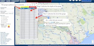
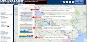
We use the LCRA hydromet to monitor river conditions.
-
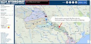
These pictures are on the LCRA Hydromet home page.
Each number along the river represents the flow rate at one of the hydromet guages.


-
500 cfs or below
- river is navigable without having to walk as low as 150 cfs
- slow water, beware of the south wind
- expect shallow quick spots and aim for the middle of the v when approaching quick water for best chance of not getting hung up
- watch out for shallow sandbars
500 – 1,000 cfs
- good paddling conditions
- you’ll feel the river moving
- wide deep stretches will still be slow and the south wind is still an enemy
- shallow quick spots will really help propel you forward for a bit
1,000 – 2,000 cfs
- ideal paddling conditions
- relax and go with the flow
2,000 – 5,000 cfs
- good paddling conditions
- there’s a lot of water coming from up stream
- either the dams have been opened or the creeks below Austin are really flowing (usually from heavy rains either south or northwest of Austin)
- its easy to cover 4-6 mph with out doing much paddling
- water is typically going to be muddier than normal from soil runoff into the river
- don’t go swimming! under currents are common and bacteria count in the water may be higher than normal from runoff
5,000 + cfs
- check with local outfitters before planning a trip
- we do not recommend first timers running the river at over 5,000 cfs
- under currents can be very strong
- debris is common result of upstream flooding
-
First and foremost, what are the recent trends on the river where you are going to be paddling? Is it going up, down, or staying pretty consistent. What’s going on up stream? Are the upstream gauges higher or lower than where you are going to be? How are they trending? What ever is happening up stream will eventually happen down stream.
Tip: Spikes in cfs at the Austin gauge (just below Longhorn Dam) usually take 12 to 24 hours to reach Bastrop. The distance between the two gauges is 62 miles.
Finally, what is going on with the weather? Compare radar patterns to a map of the Colorado River watershed. If its raining in the water shed, ALL of that water is trying to find its way into the river system.
